Atiku
The Northern and Arctic Studies Portal
Search results
1 to 2 to 2
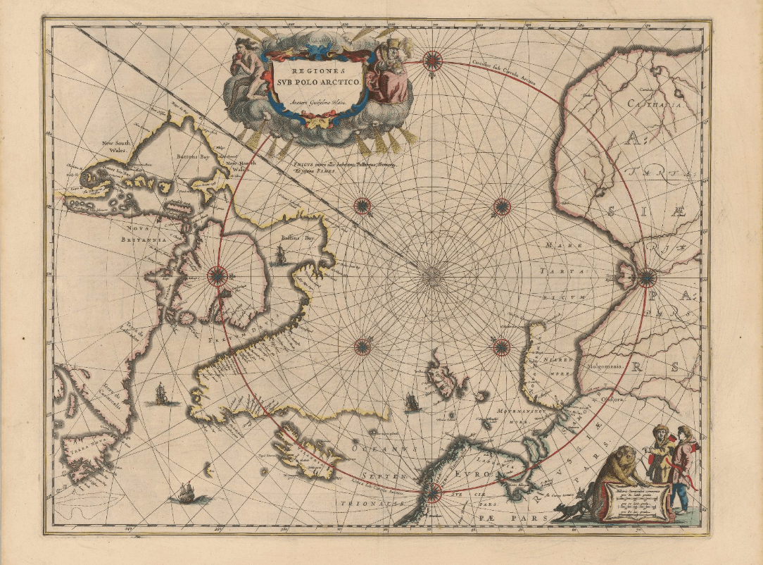
Historical maps: Arctic (BAnQ)
Corpus of fifteen old maps dating from the 17th to the 20th century. These documents bear witness to the Arctic expeditions and explorations carried out by several generations of European explorers in search of the Northwest Passage. These documents reflect the advancement of knowledge of the Arctic coastline of North America. The information on these maps is based among other things on the discoveries of Martin Frobisher, William Baffin, etc.
Subjects: Circumpolar Arctic, Cartography, Canadian arctic, Baffin bay, Arctic archipelago, Davis Strait, Greenland, Hudson Strait, Maps, Northwest Passage
- Type of access
- Free - Open Access
- Domain
- Humanities and Social Sciences
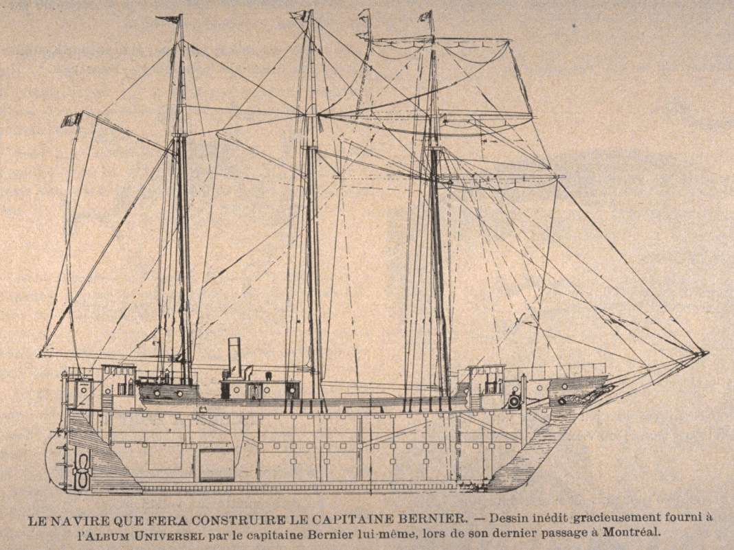
Illustrations taken from Quebec periodicals: expeditions in the arctic archipelago (BAnQ)
Dating from the end of the 19th century and the beginning of the 20th century, these illustrations taken from Quebec periodicals shed light on the wave of expeditions devoted to reaching the northern summit with a view to claiming sovereignty over the North Pole. There are old engravings of the ship Fram on which the Norwegian Fridtjof Nansen made the first transpolar drift, an image illustrating the departure of Captain J. E. Bernier during his Canadian boreal expedition, etc.
Subjects: Exploration, Canadian arctic, Arctic Ocean, Arctic archipelago
- Category.s
- Type of access
- Free - Open Access
- Domain
- Natural Sciences
- Humanities and Social Sciences