Atiku

The Northern and Arctic Studies Portal

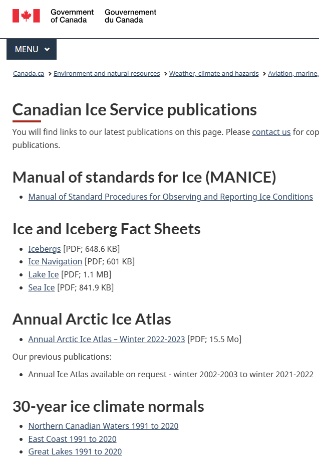
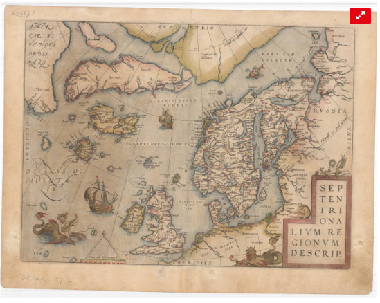
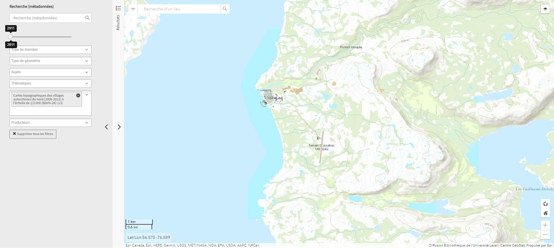
Maps, Atlases, and Geospatial Data

A selection of geographic maps, atlases, and geospatial data recommended for the study of Northern Quebec, Northern Canada, and the circumpolar North.

Some of the documents and data are freely available while others are restricted to members of the universities mentioned (restricted access), and are available under institutional licenses only. Atlases available in print format only are also recommended.

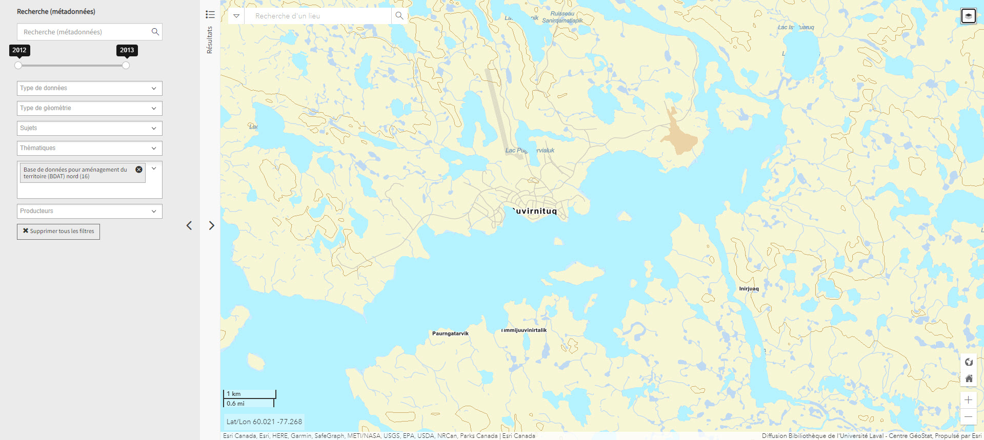
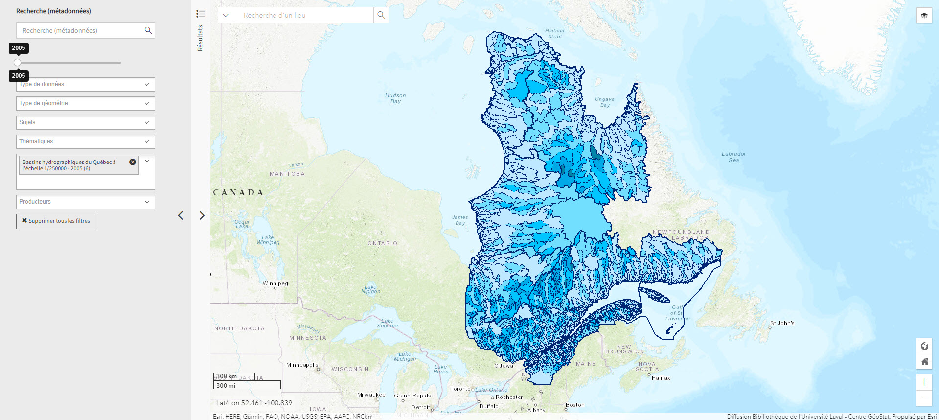
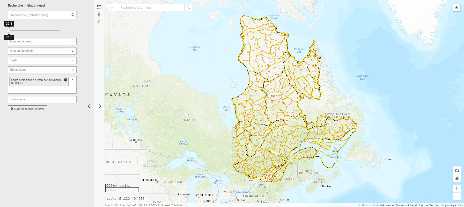
To consult the various categories and subcategories that this collection contains, use the filter Collection.

Resources

1 to 20 of 71

Adresse Québec (Géoindex)

Adresse Québec (Géoindex)

Collection of 8 layers of geospatial data illustrating roads, addresses, and postal codes.

Subjects: Geospatial data, Addresses, Postal codes, Quebec, Roads

Share this resource

To cite

Algonquian Linguistics Atlas

Algonquian Linguistics Atlas

Interactive map of Canada’s Algonquian languages, many of which are spoken in northern Indigenous communities.

Subjects: Alaska, Algonquins, Linguistic, Maps

Share this resource

To cite

Arctic Geobotanical Atlas (University of Alaska)

Arctic Geobotanical Atlas (University of Alaska)

Collection of maps illustrating the distribution of vegetation in the Arctic.

Subjects: Alaska, Atlas, Geobotany, Maps, Vegetation

Share this resource

To cite

  • Type of access
    • Free - Open Access
  • Domain
    • Natural Sciences
Locate Resource
Arctic Renewable Energy Atlas

Arctic Renewable Energy Atlas

A collection of maps on the solar, wind, geothermal, and tidal resources of the Arctic prepared by the Arctic Council’s Sustainable Development Working Group.

Subjects: Atlas, Maps, Sustainable development, Renewable energies

Share this resource

To cite

  • Type of access
    • Free - Reference only
  • Domain
    • Engineering and Technology
    • Natural Sciences
Locate Resource
Arctic Research Mapping Application

Arctic Research Mapping Application

A Web application that allows users to view the locations of Arctic research projects funded by the United States.

Subjects: Cartography, Maps, United States, Research

Share this resource

To cite

  • Type of access
    • Free - Open Access
  • Domain
    • Health Sciences
    • Humanities and Social Sciences
    • Natural Sciences
Locate Resource
Arctic Tools (Gouvernement fédéral des États-Unis)

Arctic Tools (Gouvernement fédéral des États-Unis)

Page with links to resources, including interactive mapping applications and datasets, to help understand, analyze, and assess the vulnerabilities and resilience of Arctic systems to climate variability and climate change.


  • Type of access
    • Free - Open Access
  • Domain
    • Natural Sciences
Locate Resource
Atlas climatique des glaces de mer pour les eaux du Nord canadien, 1981 à 2010

Atlas climatique des glaces de mer pour les eaux du Nord canadien, 1981 à 2010

Atlas showing average and maximum statistics for ice coverage in the Canadian Arctic and Hudson Bay.

Subjects: Atlas, Canadian arctic, Hudson Bay, Ice, Maps

Share this resource

To cite

  • Type of access
    • Free - Open Access
  • Domain
    • Natural Sciences
Locate Resource
Atlas climatiques des glaces sur 30 ans

Atlas climatiques des glaces sur 30 ans

Atlas produced by the Canadian Ice Service, which provides the location of ice during the ice season, its coverage, thickness, and variability, for the period from 1981 to 2010. Features three volumes, including one on Northern Canadian waters and another on the East Coast.

Subjects: Atlas, Canadian arctic, Ice, Maps, Northern Canada

Share this resource

To cite

  • Type of access
    • Free - Open Access
  • Domain
    • Natural Sciences
Locate Resource
Atlas des activités des chasseurs et piégeurs cris de Eeyou Istchee (Réseau DIALOG)

Atlas des activités des chasseurs et piégeurs cris de Eeyou Istchee (Réseau DIALOG)

Interactive map of the activities of hunters and trappers in nine Cree communities in Eeyou Istchee (James Bay region) produced using annual statistical data (1977 to 2011) from the Cree Hunters and Trappers Income Security Board.

Subjects: Atlas, Cree, Hunting and fishing, Indigenous peoples, Maps

Share this resource

To cite

  • Type of access
    • Free - Open Access
  • Domain
    • Humanities and Social Sciences
Locate Resource
Atlas des peuples autochtones du Canada

Atlas des peuples autochtones du Canada

Four-volume atlas presenting information on Indigenous communities, languages, education, treaties and territories, as well as residential schools, colonialism, racism and cultural appropriation. (Ottawa, Société géographique royale du Canada, 2018, 4 vol. )

Atlas des pôles : régions polaires : questions sur un avenir incertain

Atlas des pôles : régions polaires : questions sur un avenir incertain

Atlas published by Éditions Autrement presenting the physical and natural environment, First Nations, and environmental, climatic, and geopolitical issues associated with the Arctic and the Antarctic.

Subjects: Alaska, Climate change, geopolitics, Indigenous peoples

Share this resource

To cite

Atlas of Indian nations

Atlas of Indian nations

Atlas with rich iconographic, cartographic, and textual content presenting the various nations of North America according to a wide range of themes. Includes relevant content about the First Peoples of the North and the Arctic. (Washington, National Geographic Society, 2013, 219 p.)

Subjects: Atlas, Indigenous peoples, Maps

Share this resource

To cite

Atlas of Registered Aboriginal Population of Quebec (Réseau DIALOG)

Atlas of Registered Aboriginal Population of Quebec (Réseau DIALOG)

Interactive map of statistical data on the registered Indian population in Quebec from 1998 to 2010, on-reserve and off-reserve.

Subjects: Atlas, Demographic statistics, Indigenous peoples, Maps, Population

Share this resource

To cite

Locate Resource
Atlas of the North American Indian

Atlas of the North American Indian

Atlas with a focus on the history, migrations, conflicts, lifestyles, and location of Indigenous Peoples in North America. Content related to Northern Canada and Alaska.

Subjects: Alaska, Atlas, Indigenous peoples, Maps, Northern Canada

Share this resource

To cite

Base de données pour aménagement du territoire (BDAT) nord (Géoindex)

Base de données pour aménagement du territoire (BDAT) nord (Géoindex)

Collection of 22 layers of geospatial data providing an overview of northern land occupancy.

Subjects: Cartography, Geospatial data, Land occupancy, Land use planning, Quebec

Share this resource

To cite

Bassins hydrographiques du Québec à l’échelle 1/250000 (Géoindex)

Bassins hydrographiques du Québec à l’échelle 1/250000 (Géoindex)

A collection of 7 layers of geospatial data showing Quebec’s watersheds.

Subjects: Cartography, Geospatial data, Watershed area, Watersheds, Quebec

Share this resource

To cite

Cadre écologique de référence du Québec (CERQ) (Géoindex)

Cadre écologique de référence du Québec (CERQ) (Géoindex)

A collection of 4 layers of geospatial data showing ecological classification of the land and allowing users to assess its potential and constraints, and the fragility of its ecosystems.

Subjects: Cartography, Ecological classification, Geospatial data, Quebec

Share this resource

To cite

Cartes anciennes de l’Arctique (Université Laval)

Cartes anciennes de l’Arctique (Université Laval)

Collection of the University Laval’s Library consisting of some twenty maps dating from the 16th to the 20th century. These documents are the work of famous cartographers such as Gerardus Mercator, Jan Jansson, Guillaume de L’Isle and Willem Blaeu, but also of explorers like Captain Joseph-Elzéar Bernier.

Subjects: Cartography, Circumpolar Arctic, Maps

Share this resource

To cite

  • Type of access
    • Free - Open Access
  • Domain
    • Humanities and Social Sciences
Locate Resource
Cartes du Nord (Gouvernement du Canada)

Cartes du Nord (Gouvernement du Canada)

Selection of Natural Resources Canada maps on coastal areas, ice, snow, permafrost, and more.

Subjects: Maps, Northern Canada, Natural Resources

Share this resource

To cite

  • Type of access
    • Free - Open Access
  • Domain
    • Natural Sciences
Locate Resource
Cartes topographiques des villages autochtones du nord (2009-2011) à l’échelle de 1/2 000 (BDVN-2K) (Géoindex)

Cartes topographiques des villages autochtones du nord (2009-2011) à l’échelle de 1/2 000 (BDVN-2K) (Géoindex)

A collection of 22 layers of geospatial data comprising a valuable geographic reference tool for organizations working in these regions.

Subjects: Topographic maps, Northern Quebec, Topography, Villages

Share this resource

To cite

This site is registered on wpml.org as a development site.