Atiku
The Northern and Arctic Studies Portal
Search results
1 to 4 to 4
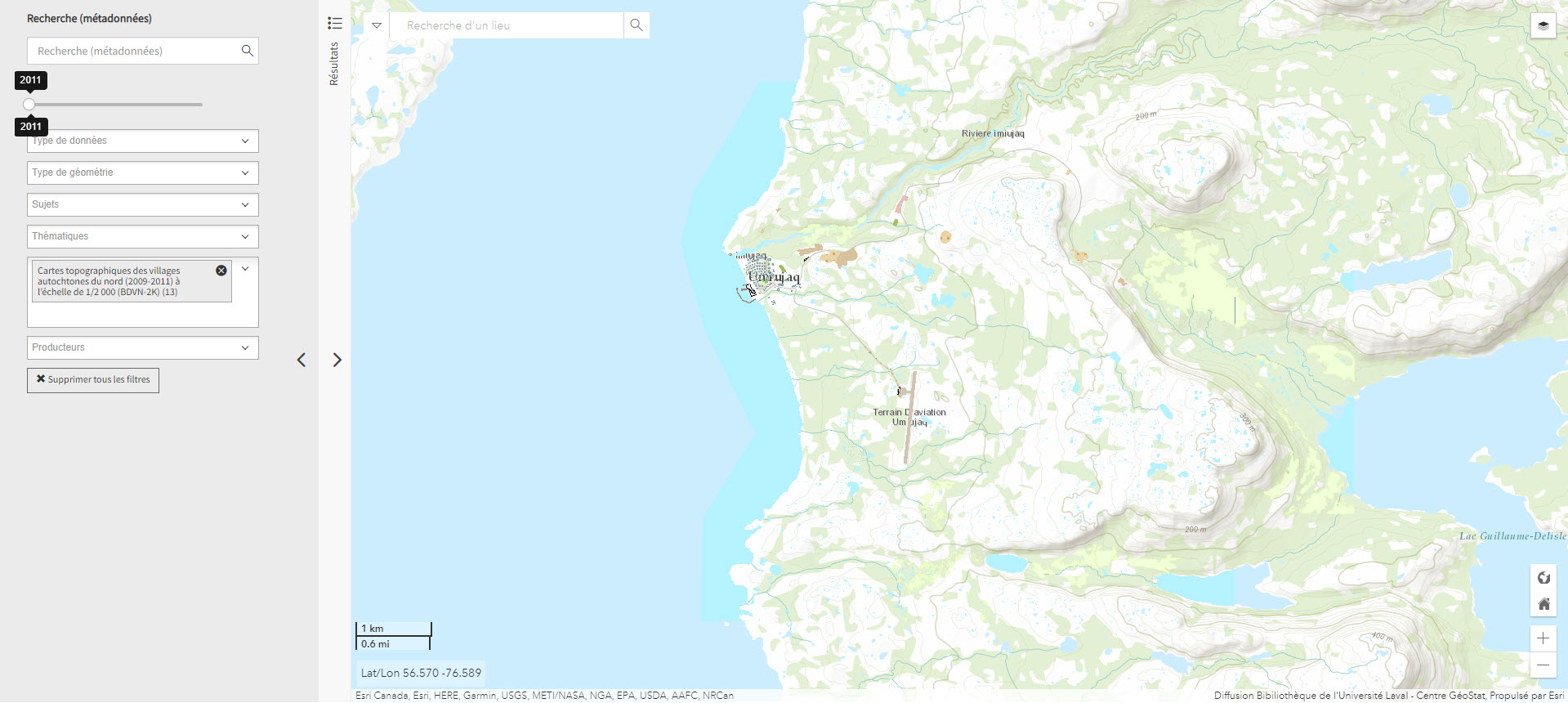
Cartes topographiques des villages autochtones du nord (2009-2011) à l’échelle de 1/2 000 (BDVN-2K) (Géoindex)
A collection of 22 layers of geospatial data comprising a valuable geographic reference tool for organizations working in these regions.
Subjects: Topographic maps, Northern Quebec, Topography, Villages
- Type of access
- Reserved Access
- Domain
- Humanities and Social Sciences
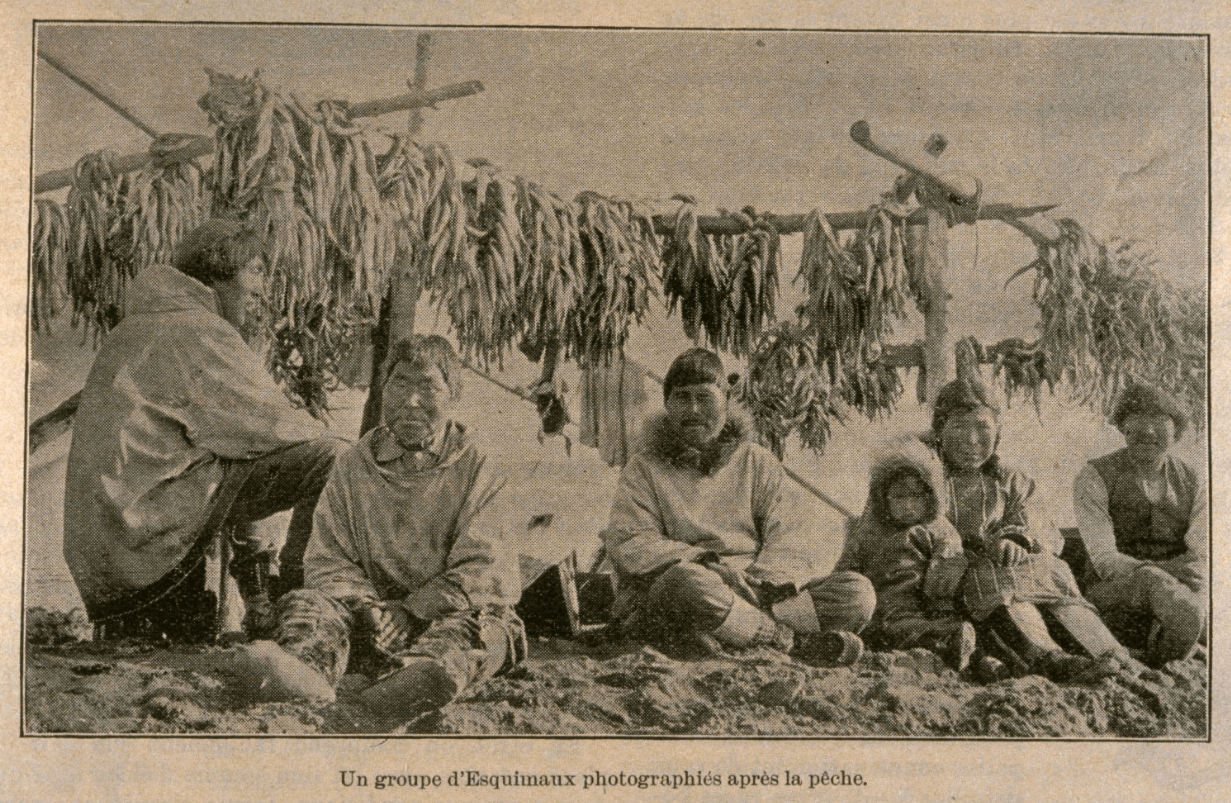
Illustrations taken from Quebec periodicals: Inuit mores and customs (BAnQ)
19th century documentary iconography corpus. These images, taken from Quebec magazines: L’Opinion publique (1870-1883), Monde Illustré (1884-1902,1907) and L’Album Univers (1902-1907), paint a picture of the cultural and social life of the Inuit in a time when photographs were uncommon.
Subjects: Villages, Cultural identity, Hunting and fishing, Inuit
- Type of access
- Free - Open Access
- Domain
- Humanities and Social Sciences
- Natural Sciences
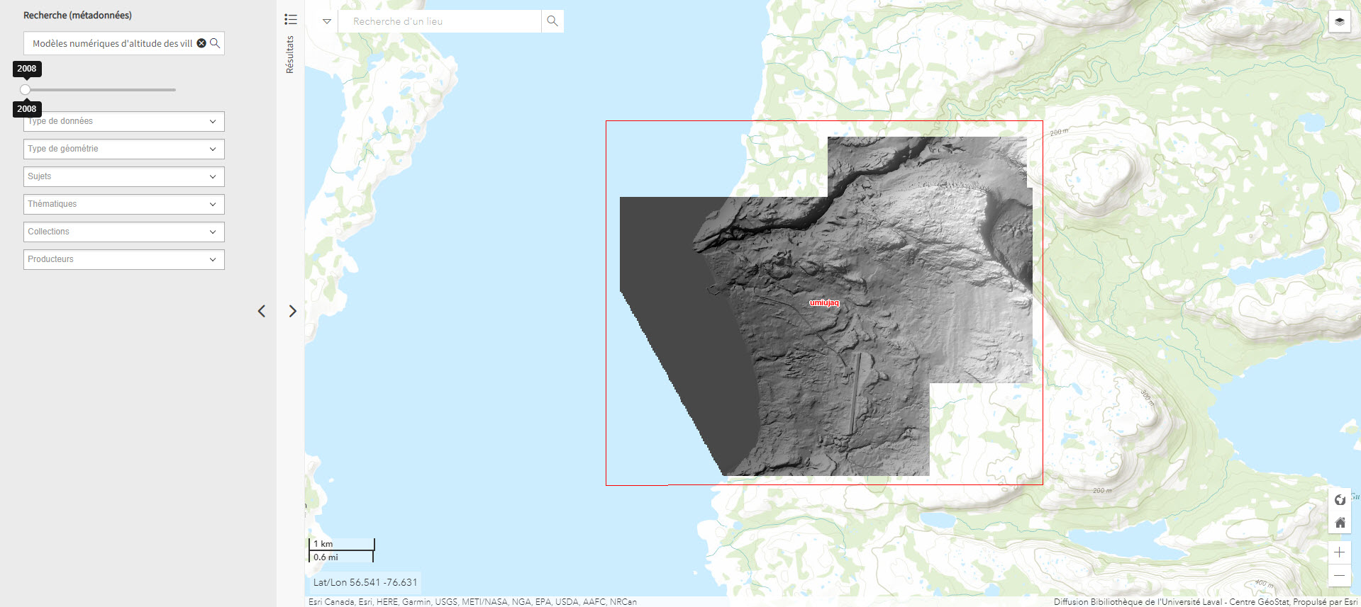
Modèles numériques d’altitude des villages nordiques à l’échelle 1/2 000 (Géoindex)
Includes digital elevation models covering Inuit villages located north of the 55th parallel. The documents in this series are digital elevation matrices accurate to within one metre.
Subjects: Digital elevation model, Indigenous peoples, Inuit, Villages, Geospatial data
- Type of access
- Reserved Access
- Domain
- Humanities and Social Sciences
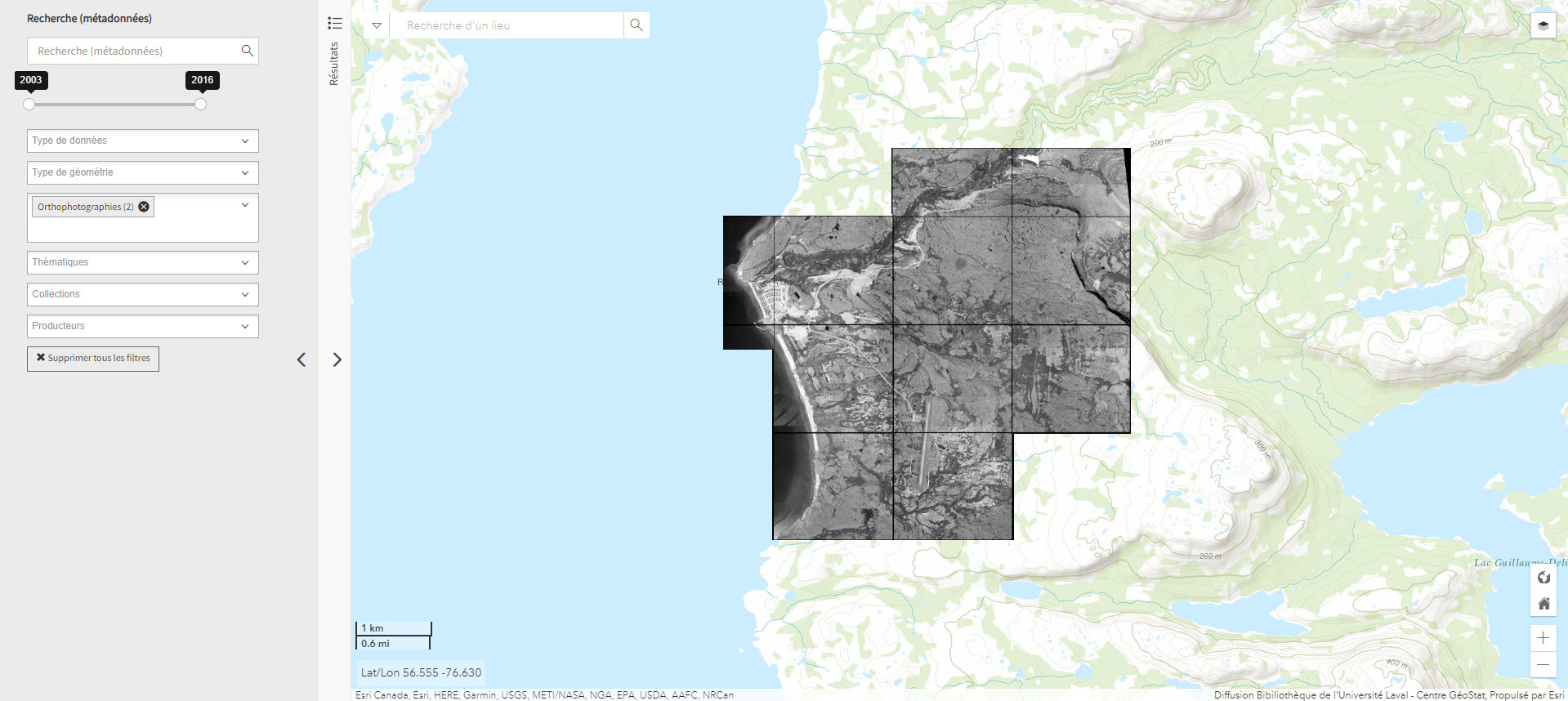
Orthophotographie noir et blanc des villages nordiques 1/10 000 (2004) (Géoindex)
Set of 161 digital orthophotos representing northern villages (1:10,000).
Subjects: Indigenous peoples, Inuit, Orthophotographs, Quebec, Villages
- Type of access
- Reserved Access
- Domain
- Humanities and Social Sciences