Atiku
The Northern and Arctic Studies Portal
Resources
1 to 12 of 12
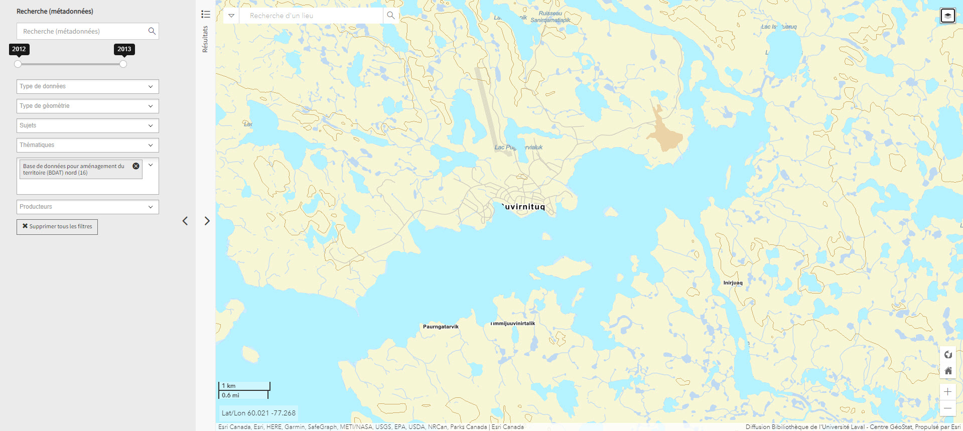
Base de données pour aménagement du territoire (BDAT) nord (Géoindex)
Collection of 22 layers of geospatial data providing an overview of northern land occupancy.
Subjects: Cartography, Geospatial data, Land occupancy, Land use planning, Quebec
Share this resource
To cite
- Type of access
- Reserved Access
- Domain
- Humanities and Social Sciences
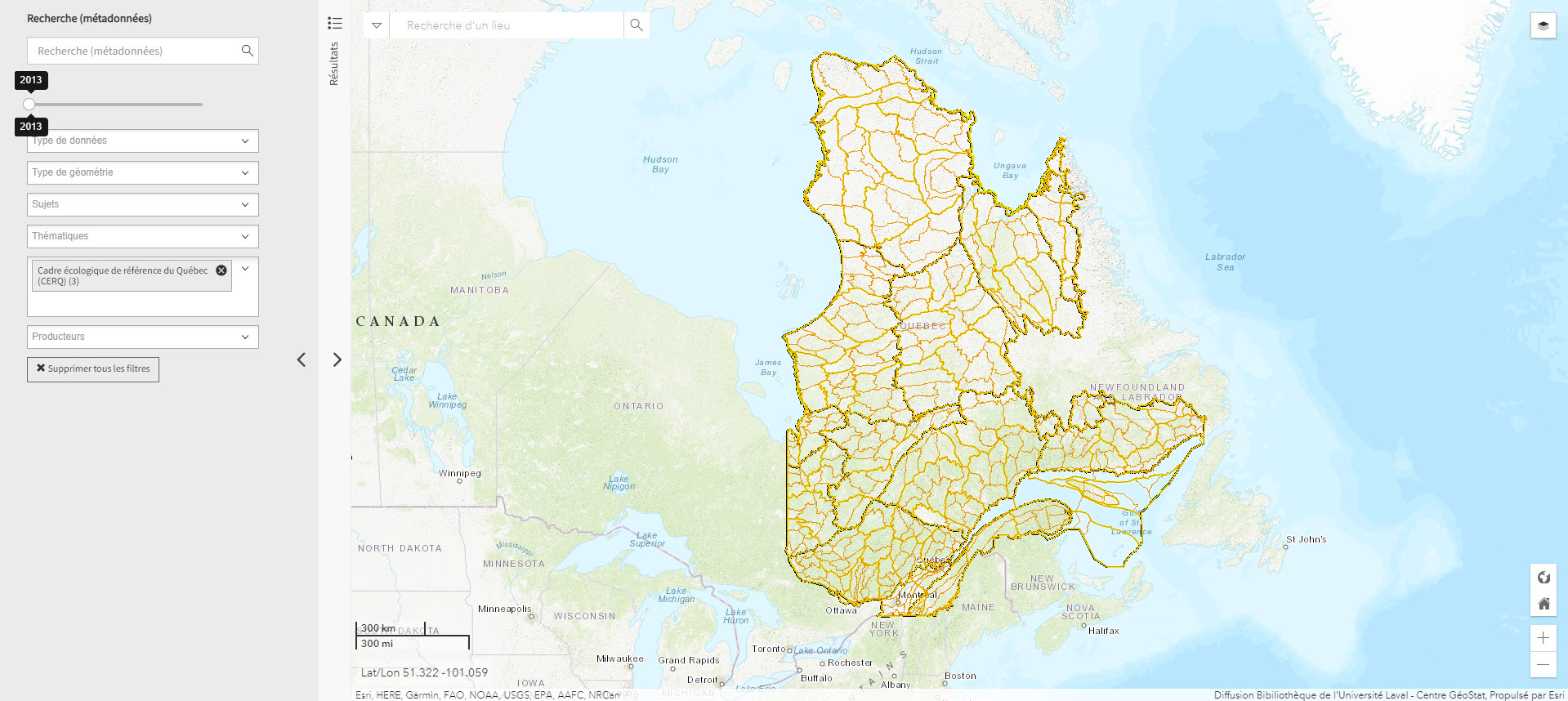
Cadre écologique de référence du Québec (CERQ) (Géoindex)
A collection of 4 layers of geospatial data showing ecological classification of the land and allowing users to assess its potential and constraints, and the fragility of its ecosystems.
Subjects: Cartography, Ecological classification, Geospatial data, Quebec
Share this resource
To cite
- Type of access
- Reserved Access
- Domain
- Natural Sciences
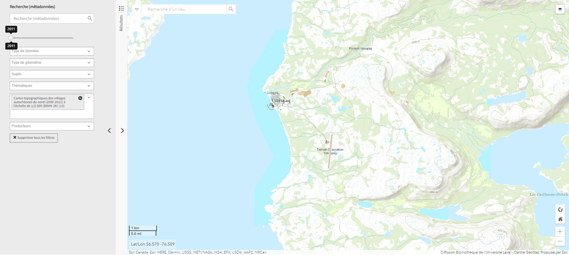
Cartes topographiques des villages autochtones du nord (2009-2011) à l’échelle de 1/2 000 (BDVN-2K) (Géoindex)
A collection of 22 layers of geospatial data comprising a valuable geographic reference tool for organizations working in these regions.
- Type of access
- Reserved Access
- Domain
- Humanities and Social Sciences
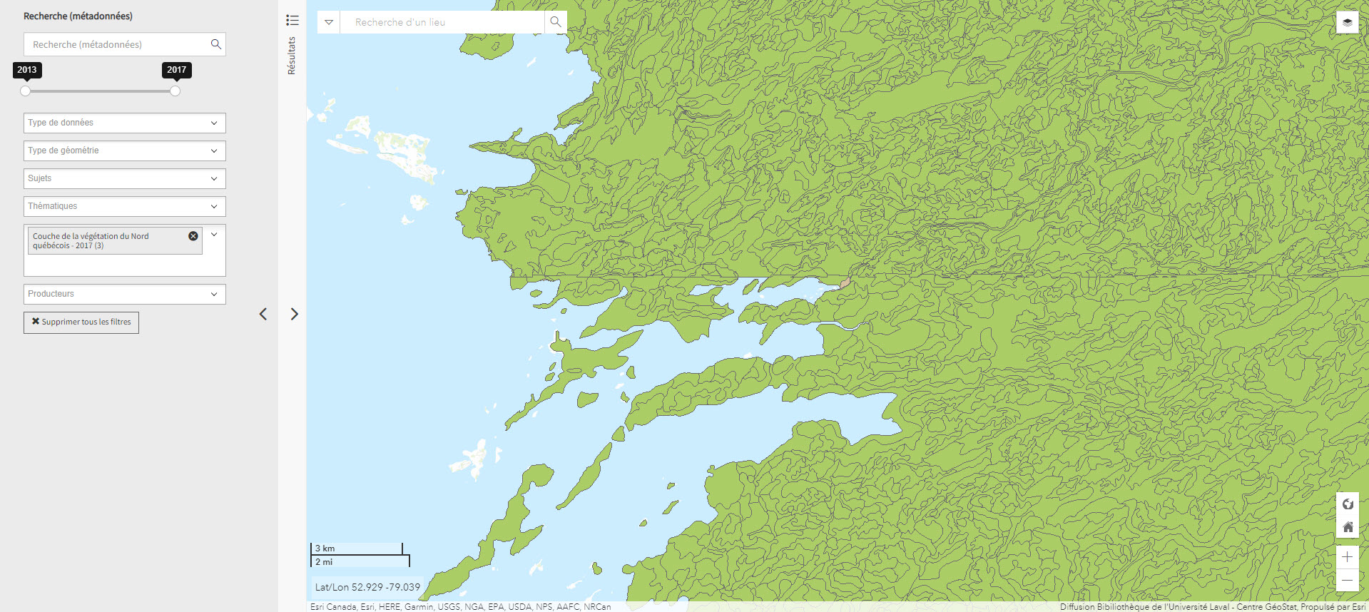
Couche de la végétation du Nord québécois (Géoindex)
A collection of 2 layers of geospatial data illustrating settlements and logging roads between the 53rd and 55th parallels.
Subjects: Forest stands, Forestry roads, Geospatial data, Northern Quebec, Vegetation
Share this resource
To cite
- Type of access
- Reserved Access
- Domain
- Natural Sciences
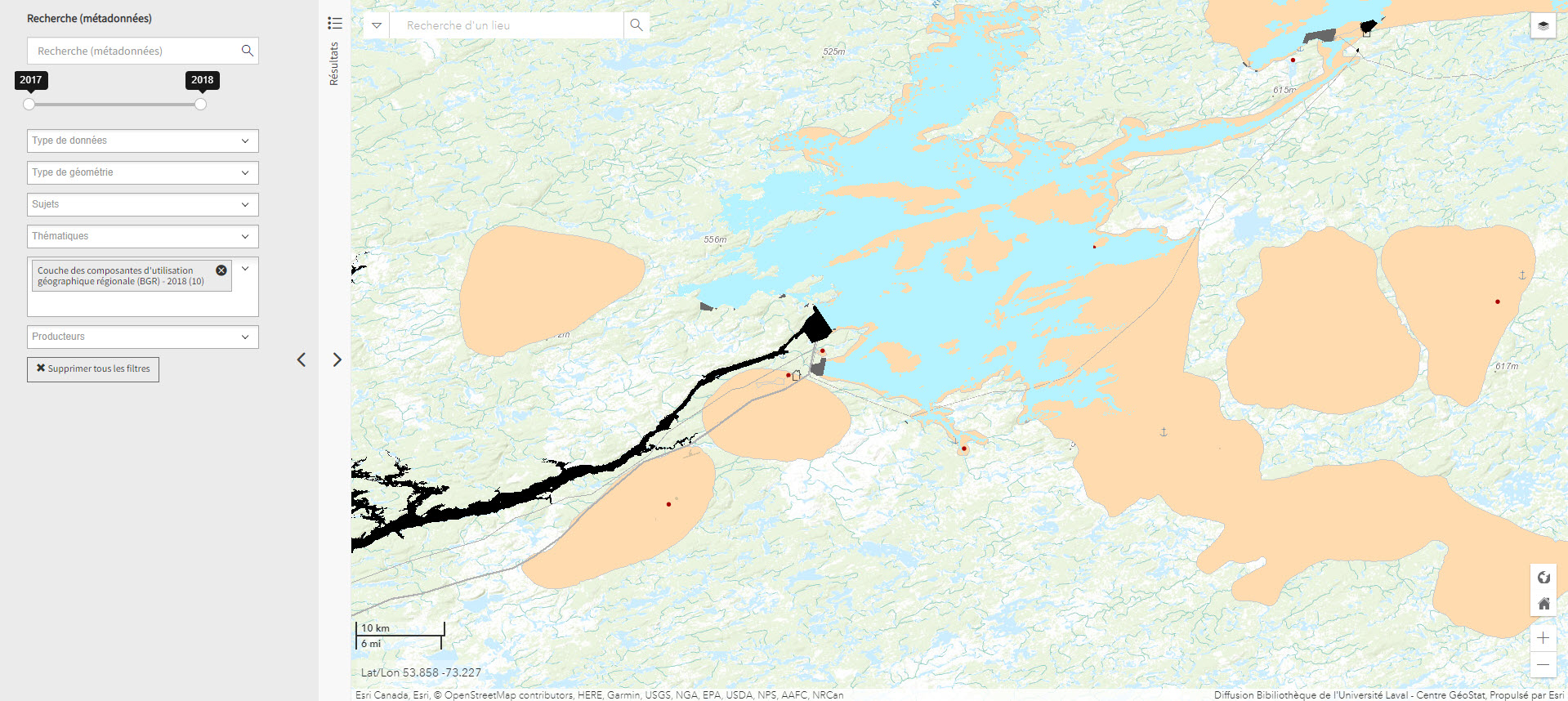
Couche des composantes d’utilisation géographique régionale (BGR) – 2015 (Géoindex)
A collection of 24 layers that show the position and type of elements that make up Quebec’s regional geographic base, including energy facilities, ATV trails, snowshoe trails, wind turbines, etc.
Subjects: Energy equipment, Geospatial data, Regional geographic basis, Wind energy equipment, Quebec
Share this resource
To cite
- Type of access
- Reserved Access
- Domain
- Engineering and Technology
- Humanities and Social Sciences
- Natural Sciences
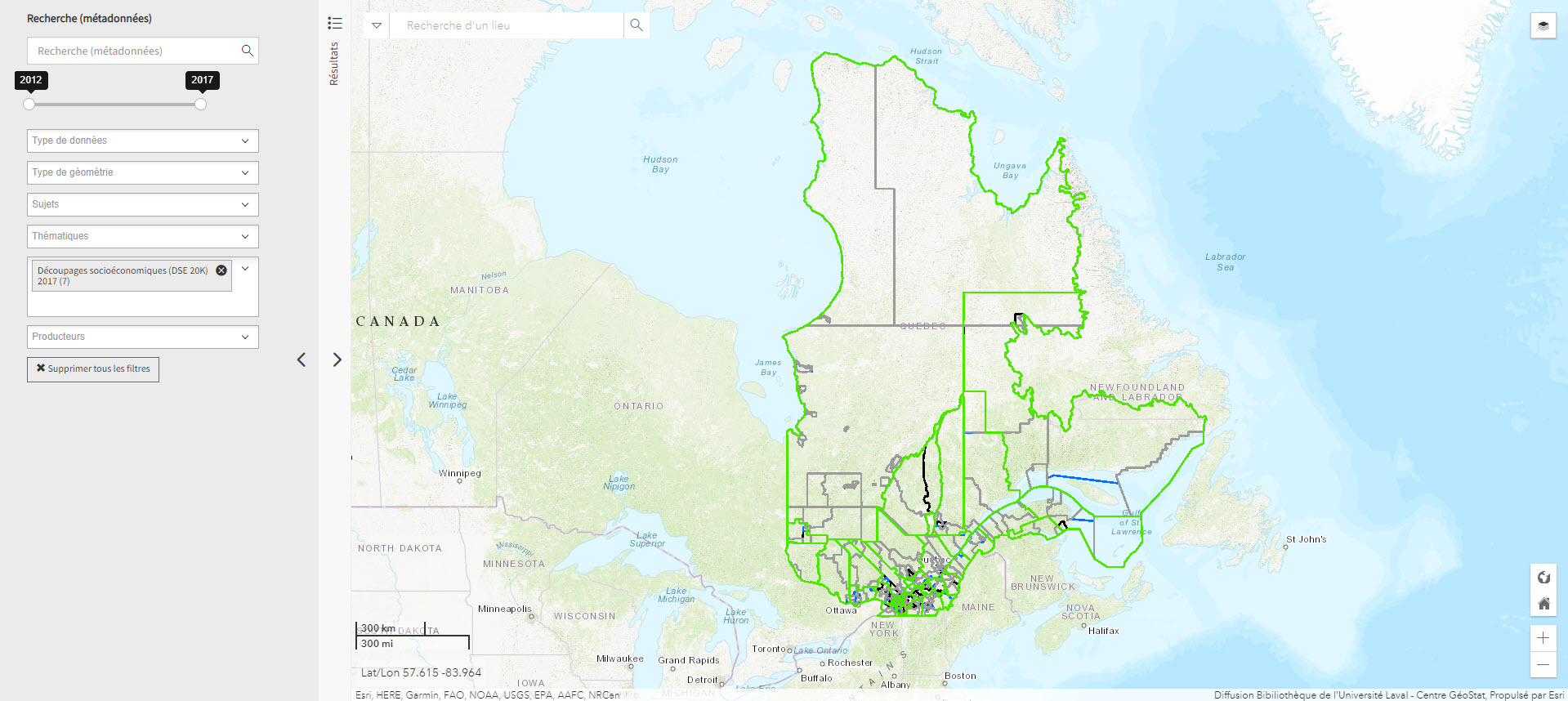
Découpages socio-économiques (DSE 20K) 2017 (Géoindex)
A collection of 7 layers of geospatial data for Quebec representing certain boundaries in the fields of health, elections, education, justice, and land.
- Type of access
- Reserved Access
- Domain
- Humanities and Social Sciences

Données Québec – Environnement, ressources naturelles et énergie (Gouvernement du Québec)
Selection of geospatial data from Quebec’s Department of Energy and Natural Resources.
Subjects: Cartography, Energy, Geospatial data, Quebec, Natural Resources
Share this resource
To cite
- Type of access
- Free - Open Access
- Domain
- Engineering and Technology
- Natural Sciences
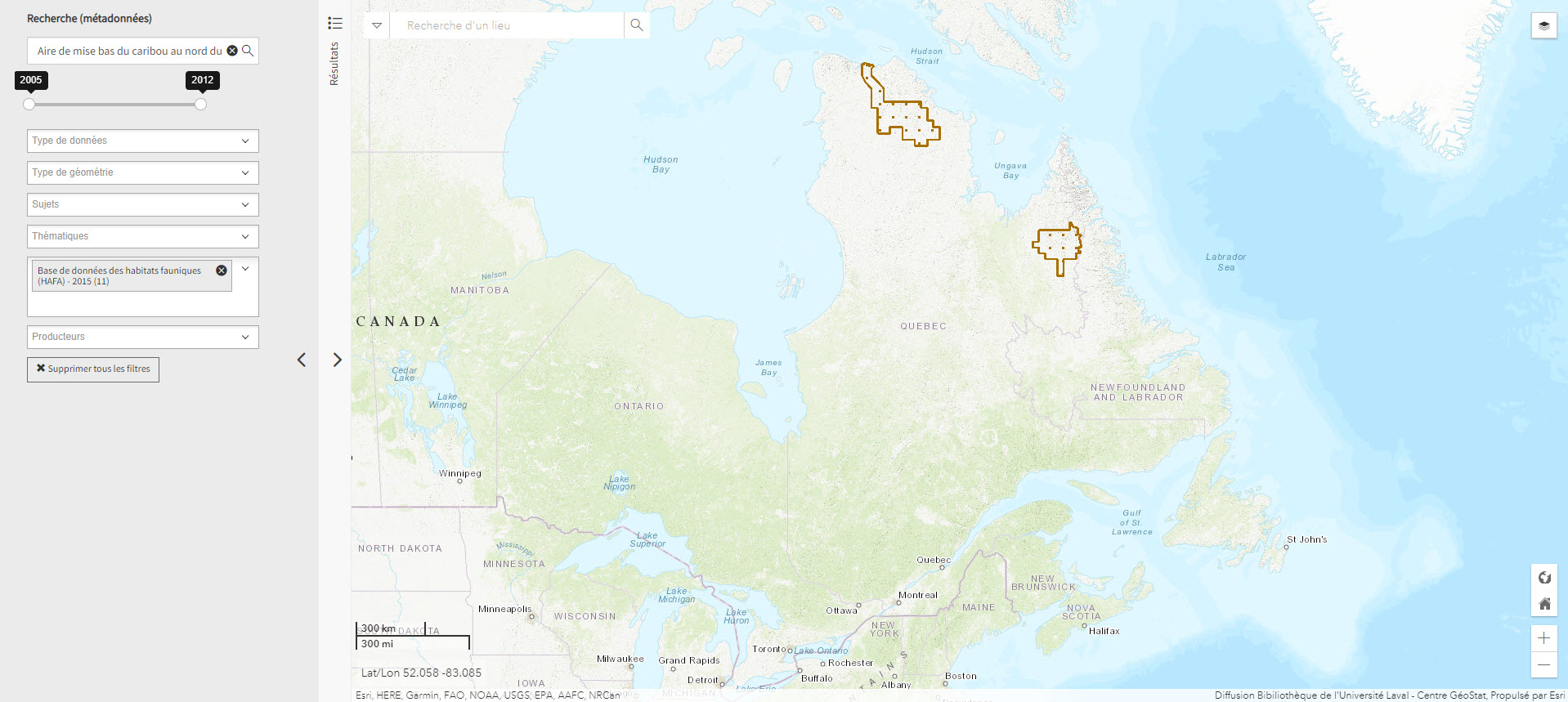
Mise bas du caribou (Géoindex)
This layer shows the location of caribou calving grounds north of the 52nd parallel.
- Type of access
- Reserved Access
- Domain
- Natural Sciences
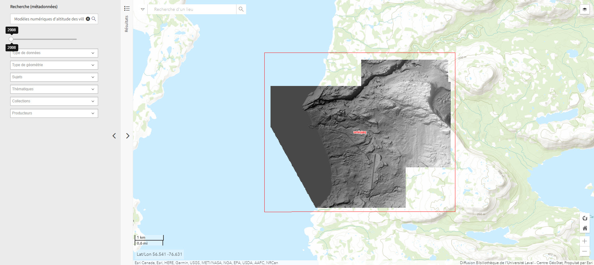
Modèles numériques d’altitude des villages nordiques à l’échelle 1/2 000 (Géoindex)
Includes digital elevation models covering Inuit villages located north of the 55th parallel. The documents in this series are digital elevation matrices accurate to within one metre.
Subjects: Digital elevation model, Geospatial data, Indigenous peoples, Inuit, Villages
Share this resource
To cite
- Type of access
- Reserved Access
- Domain
- Humanities and Social Sciences
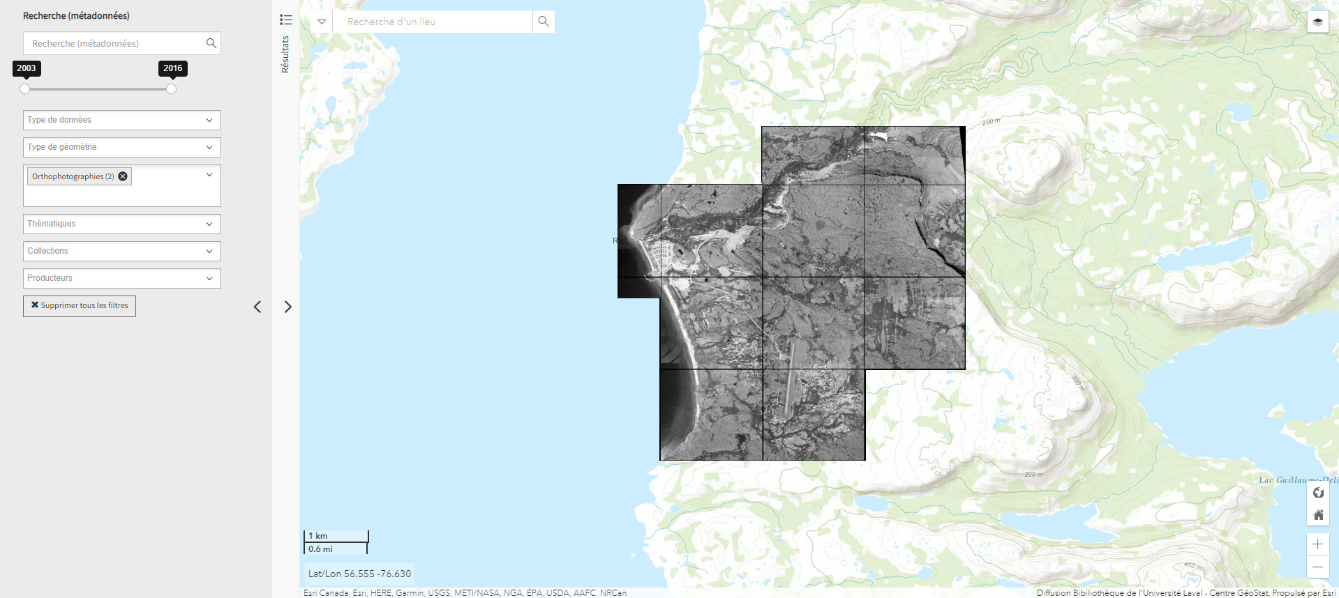
Orthophotographie noir et blanc des villages nordiques 1/10 000 (2004) (Géoindex)
Set of 161 digital orthophotos representing northern villages (1:10,000).
- Type of access
- Reserved Access
- Domain
- Humanities and Social Sciences
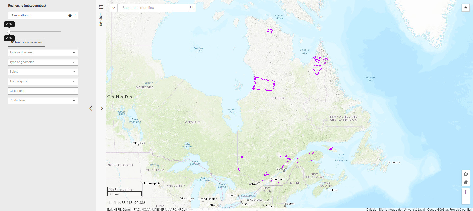
Parc national du Québec (Géoindex)
Layer of geospatial data representing Quebec’s provincial parks in the form of polygons, scale 1:100,000.
- Type of access
- Reserved Access
- Domain
- Natural Sciences
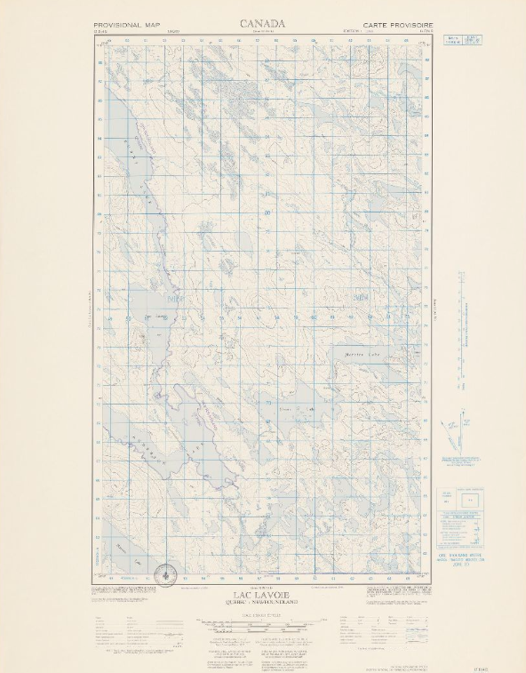
Topographic maps (NTS 13: Côte-Nord)
Corpus of topographic maps of the North Shore of Quebec at a scale of 1: 50,000. The first level NTS number representing the geographic area concerned is 13.
- Type of access
- Free - Open Access
- Domain
- Natural Sciences