Atiku
The Northern and Arctic Studies Portal
Search results
1 to 16 to 16
Arctic Center / Arctic region : Basic information about the Arctic (Arctic Centre. University of Lapland)
General information on various aspects of the Arctic, including Indigenous peoples, climate change, international cooperation, flora and fauna, mapping, etc.
(Arctic Centre. University of Lapland. 2020. «Basic information about the Arctic». URL [https://www.arcticcentre.org/EN/arcticregion])
Subjects: Arctic fauna, Arctic flora, Cartography, Circumpolar Arctic, Climate change, Indigenous peoples
- Category.s
- Type of access
- Free - Open Access
- Domain
- Humanities and Social Sciences
- Natural Sciences
Arctic Research Mapping Application
A Web application that allows users to view the locations of Arctic research projects funded by the United States.
Subjects: Cartography, Maps, United States, Research
- Type of access
- Free - Open Access
- Domain
- Health Sciences
- Humanities and Social Sciences
- Natural Sciences
Arctic Tools (Gouvernement fédéral des États-Unis)
Page with links to resources, including interactive mapping applications and datasets, to help understand, analyze, and assess the vulnerabilities and resilience of Arctic systems to climate variability and climate change.
Subjects: Cartography, Circumpolar North, Climate change, Climate variability, Geospatial data
- Type of access
- Free - Open Access
- Domain
- Natural Sciences
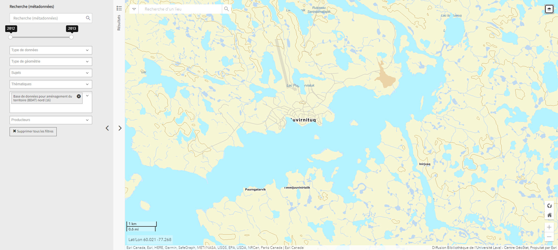
Base de données pour aménagement du territoire (BDAT) nord (Géoindex)
Collection of 22 layers of geospatial data providing an overview of northern land occupancy.
Subjects: Cartography, Geospatial data, Land occupancy, Land use planning, Quebec
- Type of access
- Reserved Access
- Domain
- Humanities and Social Sciences
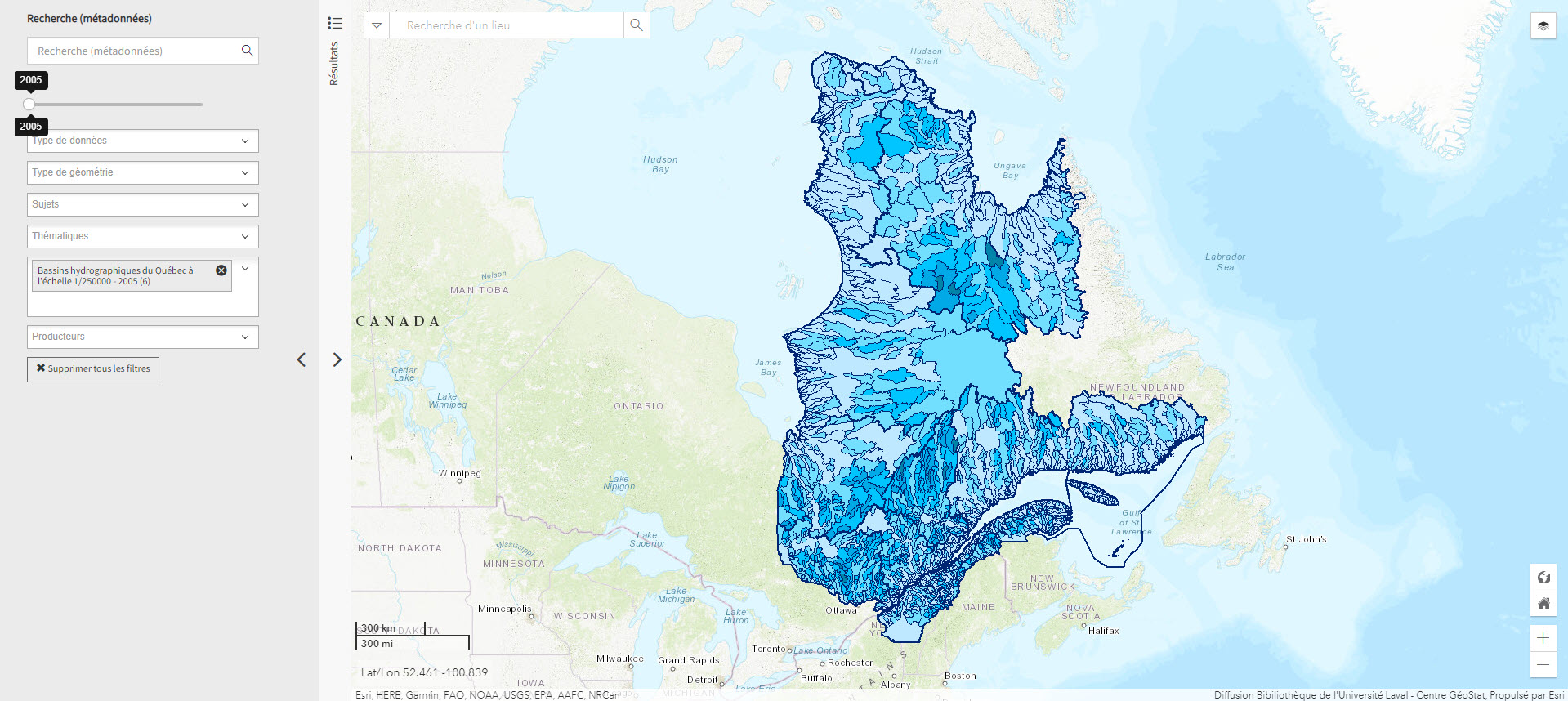
Bassins hydrographiques du Québec à l’échelle 1/250000 (Géoindex)
A collection of 7 layers of geospatial data showing Quebec’s watersheds.
Subjects: Cartography, Geospatial data, Watershed area, Watersheds, Quebec
- Type of access
- Reserved Access
- Domain
- Natural Sciences
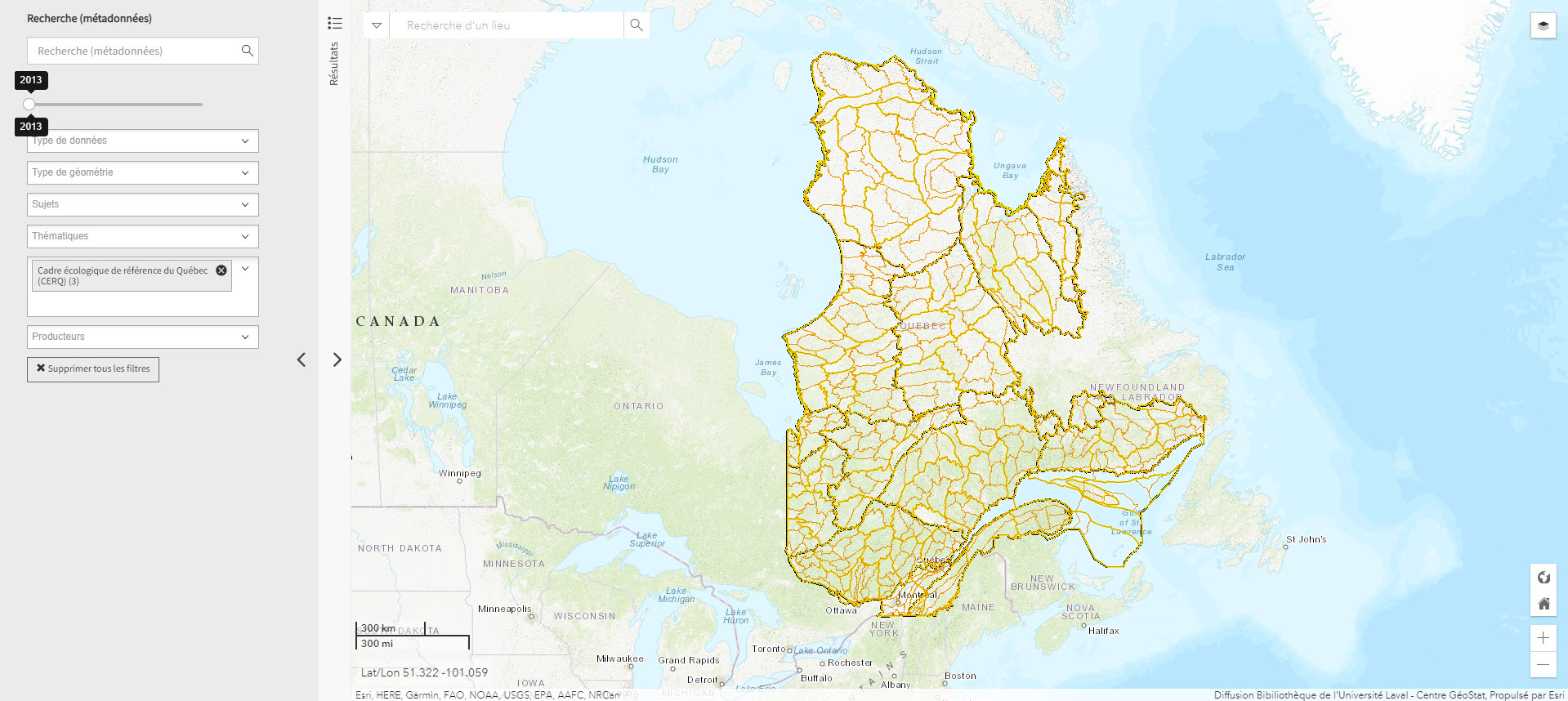
Cadre écologique de référence du Québec (CERQ) (Géoindex)
A collection of 4 layers of geospatial data showing ecological classification of the land and allowing users to assess its potential and constraints, and the fragility of its ecosystems.
Subjects: Cartography, Ecological classification, Geospatial data, Quebec
- Type of access
- Reserved Access
- Domain
- Natural Sciences
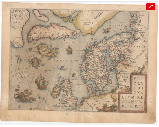
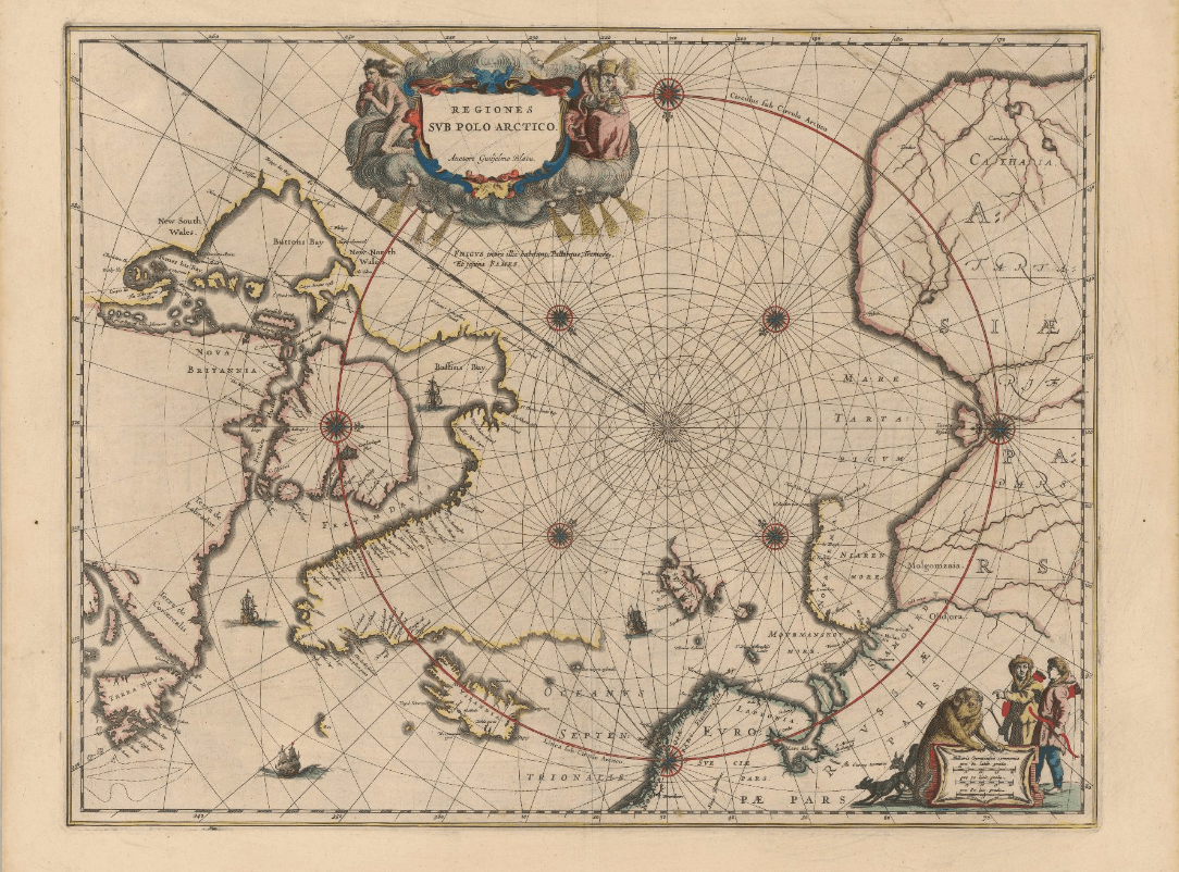
Cartes anciennes de l’Arctique (Université Laval)
Collection of the University Laval’s Library consisting of some twenty maps dating from the 16th to the 20th century. These documents are the work of famous cartographers such as Gerardus Mercator, Jan Jansson, Guillaume de L’Isle and Willem Blaeu, but also of explorers like Captain Joseph-Elzéar Bernier.
Subjects: Cartography, Circumpolar Arctic, Maps
- Type of access
- Free - Open Access
- Domain
- Humanities and Social Sciences

Données Québec – Environnement, ressources naturelles et énergie (Gouvernement du Québec)
Selection of geospatial data from Quebec’s Department of Energy and Natural Resources.
Subjects: Cartography, Energy, Geospatial data, Quebec, Natural Resources
- Type of access
- Free - Open Access
- Domain
- Engineering and Technology
- Natural Sciences
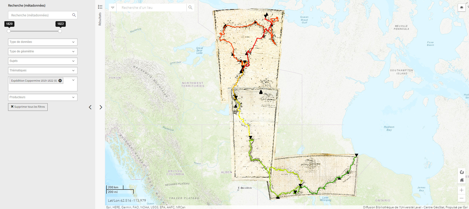
Expédition Coppermine (1819-1822) (Géoindex)
This collection of 6 layers of geospatial data is a spatial and historical reference tool on the Coppermine expedition headed by British explorer John Franklin between 1819 and 1822. An educational and research tool for the polar regions.
Subjects: Cartography, Coppermine expedition, Exploration, Geospatial data, John Franklin
- Type of access
- Reserved Access
- Domain
- Humanities and Social Sciences
- Natural Sciences
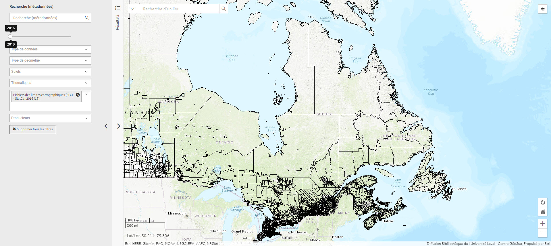
Fichier de limites cartographique de Statistiques Canada (2016) (Géoindex)
A collection of 13 layers of geospatial data representing the boundaries of census data release units by Statistics Canada. When used in conjunction with census data, these files are useful for thematic mapping.
Subjects: Cartography, Census, Geospatial data
- Type of access
- Reserved Access
- Domain
- Humanities and Social Sciences
GéoInfo – Territoire nordique (Gouvernement du Québec)
Compilation of data on Northern Quebec, some of which is freely accessible.
Subjects: Cartography, Geospatial data, Northern Quebec
- Type of access
- Free - Reference only
- Free - Open Access
- Domain
- Humanities and Social Sciences
- Natural Sciences
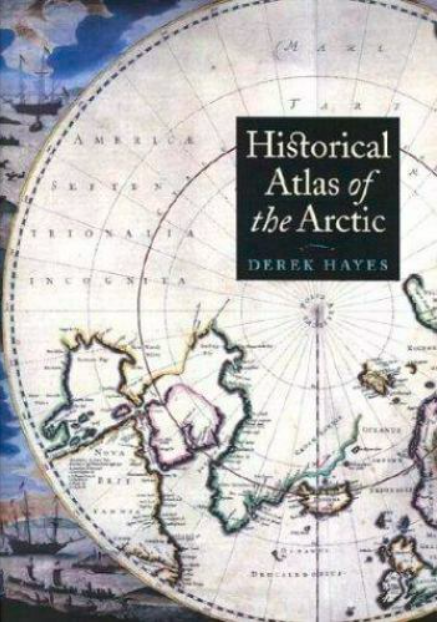
Historical atlas of the Arctic
An atlas presenting five centuries of polar exploration and mapping, from the first-ever print map of the region (Mercator, 1595) to contemporary mapping of the ocean depths using multibeam bathymetry.
Subjects: Atlas, Cartography, Discovery, Exploration, History
- Type of access
- Printed document
- Domain
- Humanities and Social Sciences
Historical maps: Arctic (BAnQ)
Corpus of fifteen old maps dating from the 17th to the 20th century. These documents bear witness to the Arctic expeditions and explorations carried out by several generations of European explorers in search of the Northwest Passage. These documents reflect the advancement of knowledge of the Arctic coastline of North America. The information on these maps is based among other things on the discoveries of Martin Frobisher, William Baffin, etc.
Subjects: Arctic archipelago, Baffin bay, Canadian arctic, Cartography, Circumpolar Arctic, Davis Strait, Greenland, Hudson Strait, Maps, Northwest Passage
- Type of access
- Free - Open Access
- Domain
- Humanities and Social Sciences
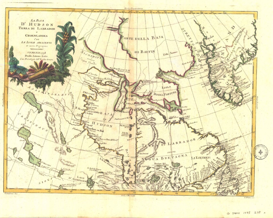
Historical maps: Hudson’s Bay (BAnQ)
Corpus of historical maps dating from the 17th and 18th century and allowing to visualize the territorial evolution of Hudson Bay. Their representation of Hudson’s Bay is inspired, among other things, by the explorations of Henry Hudson and Thomas James. These maps relate the French and English expeditions to this much coveted territory because of its strategic positioning for the fur trade in Europe.
Subjects: Cartography, Hudson Bay, Hudson’s Bay Company, Maps, New France
- Type of access
- Free - Open Access
- Domain
- Humanities and Social Sciences
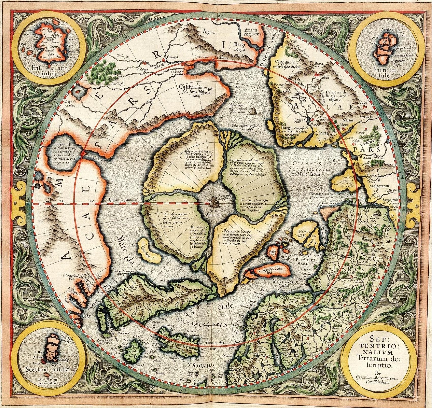
L’Apparition du Nord selon Gérard Mercator (Université Laval)
Web platform that offers an interactive reading of the first printed map (1595) of the circumpolar North.
Subjects: Cartography, Circumpolar North, Gerardus Mercator, Maps, Polar projection
- Type of access
- Printed document
- Free - Open Access
- Domain
- Humanities and Social Sciences
Polar data catalogue
A catalogue of metadata and polar data, including geospatial data, that describes and provides access to data generated by Arctic and Antarctic researchers.
Subjects: Cartography, Circumpolar North, Geospatial data, Metadata, Research
- Type of access
- Free - Reference only
- Free - Open Access
- Domain
- Engineering and Technology
- Health Sciences
- Humanities and Social Sciences
- Natural Sciences